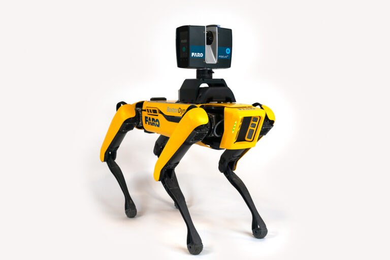
FARO Trek 3D Laser Scanning Integration

Once upon a time, employing a worker to perform reality capture with laser scanners on a construction site was the only viable option. However, as of right now, you can submit the Boston Dynamics Spot Mobile Robot as an alternative. Spot can repeat your scanning trip as needed for continuous progress monitoring and quality checks; just walk it through the project once to record it. Employing FARO Trek 3D Laser Scanning Integration, Spot is compatible with any FARO Focus S Laser Scanner and allows for independent scanning.
The Focus HDR feature ensures that users’ scan results are never compromised by difficult lighting conditions. Filmed in extremely bright or dark conditions, predefined HDR profiles improve the captured image quality.
Constant Vigilance for Construction Quality Management
It is simple to compare the progressive scans of a job site to the design model or to each other when the same area is scanned at different stages of construction from the same scan locations. It’s the simplest approach to continuously check on progress and accuracy when constructing big structures, such hospitals, data centres, energy facilities, multi-story commercial buildings, and more, without having to divert employees from their regular work. The reality capture data can be swiftly shared for simple teamwork.
Digital Twin for Facility and Asset Administration
For the duration of the building, use the final as-built collected data as a guide when managing assets throughout the facility. As a construction project comes to an end, give the owner point clouds or 3D models of the finished structure to utilize as as-built documentation.
FARO Trek 3D Laser Scanning Integration Features
Complete Set
Complete with a physical mount and a unique code for the Spot CORE, Trek offers all the components required to outfit Spot with a FARO Focus S Laser Scanner.
High Degrees of Precision
Best mobile scanning option for high accuracy
Perfect for Maps, Both Internal and External
Best option for scanning indoors and outdoors because of its 120-meter range and smooth transition between the two.
Positioned Scans in advance
For an optimal cloud-to-cloud registration, scans are precisely pre-positioned using the sensor metadata from Spot.
Coordinate System Defined by Users
Project coordinates may be easily aligned with scan.
The One-Stop Mapping Service
True all-in-one solution; it can be used as a monopod for stationary Flash scanning, a car mount for capturing bigger regions, a backpack for rough terrain and a cradle for descending into a mine shaft.
Download the Brochure
— click here
